Posts tagged: terrain


Using AWS Batch to Generate Mapzen Terrain Tiles
How to use modern cloud technology to render billions of terrain tiles for the Mapzen Terrain Tiles dataset.
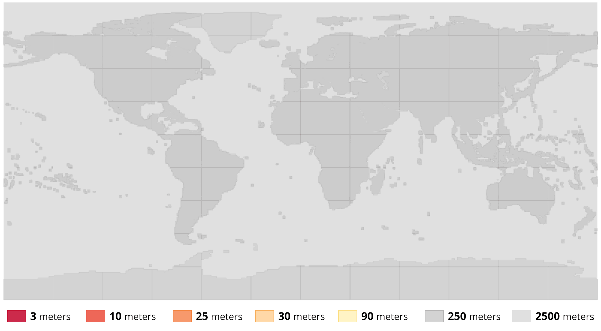
Terrain Tiles v1.1 Update
The v1.1 Mapzen Terrain Tiles update adds more detailed data in more countries using modern cloud technology.
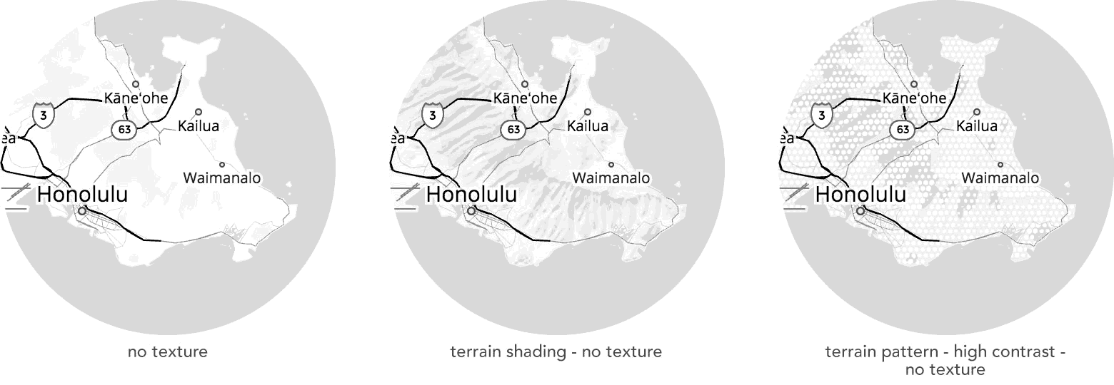
Terrain Generalization
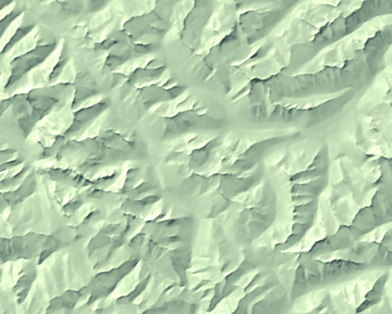
Generalization blending is a way to solve two problems at once – terrain data contains small details which aren't necessary for understanding the shape and location of important features, but basic simplification methods such as blurring are applied everywhere indiscriminately.
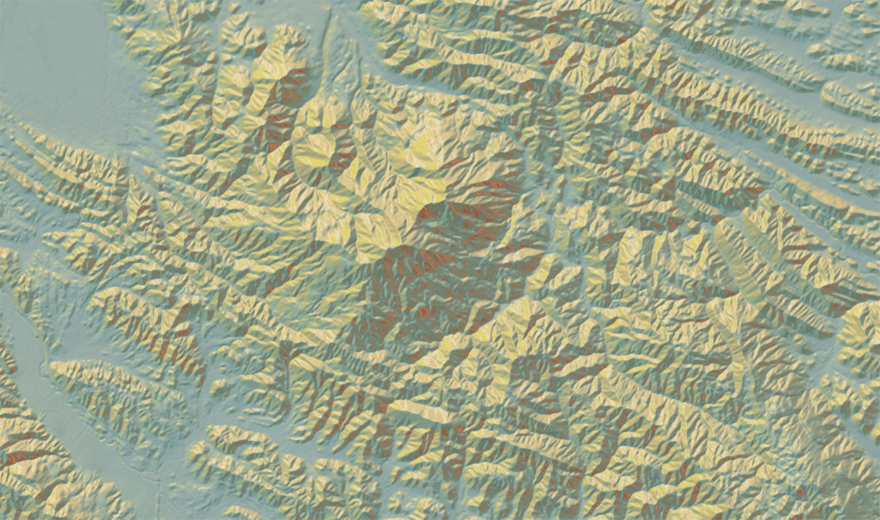
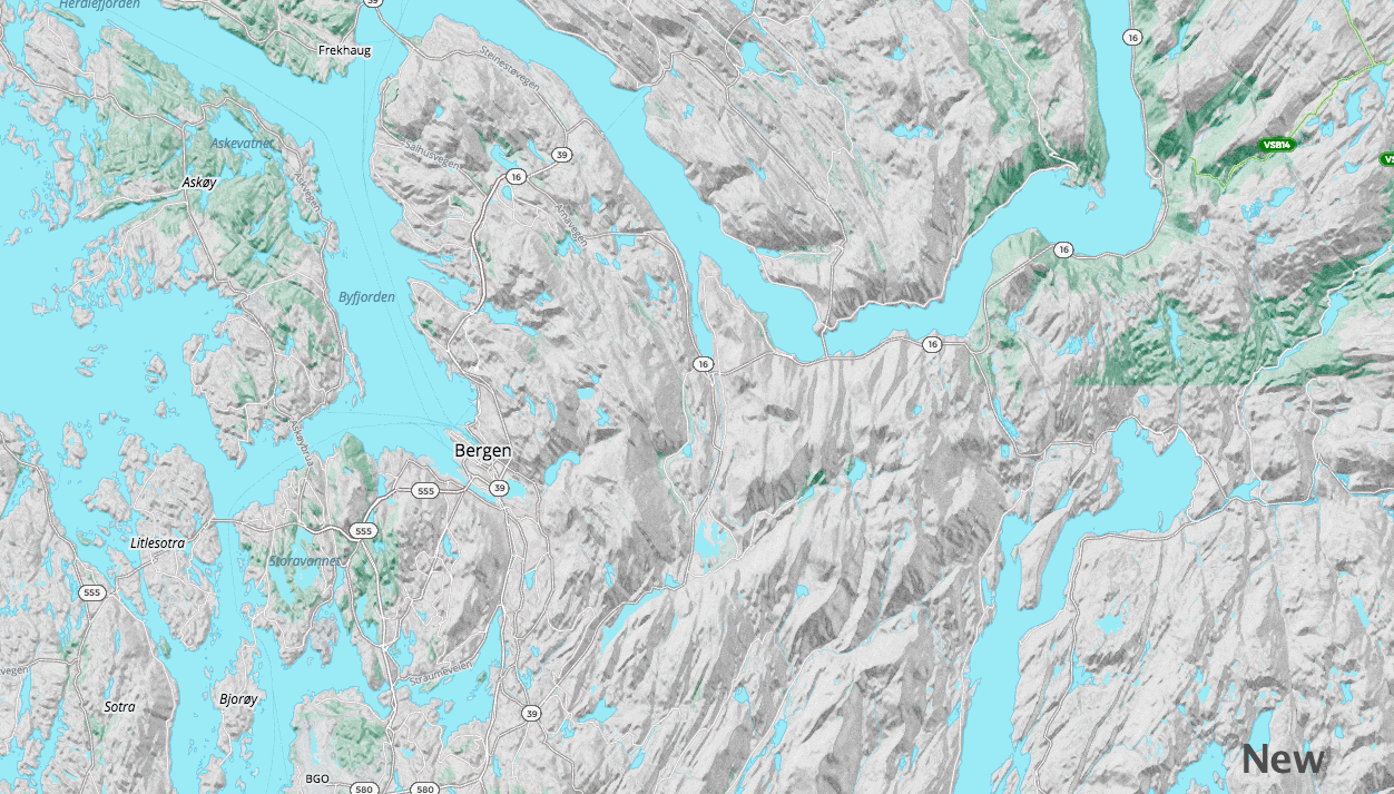
Tangram Heightmapper
This view also reveals surface details which aren't easily visible even in a 3D model. By turning up the contrast on the data, it provides glimpses into the deep history of the landscape, hidden in small differences in the terrain.