Are you sticking to your 2016 New Year’s Resolutions? At Mapzen, our goal was to “shape up” in the new year too, and thanks to some route guidance improvements, the user will be heading in the right (correct) direction. Whether the shape of your path is a fork, a circle, or a ’T’, these latest improvements are certain to provide clarity. Since the June State of the Map US Conference, we have been continuing to improve the narrative with regards to car, bicycle, and pedestrian modes of transportation. We’ve included some before and after examples to better explain the enhancements.
Car Narrative Improvement
We added code to identify and process forks. Forks typically occur at highway-to-highway transitions with the absence of a ramp or at ramp-to-ramp transitions.
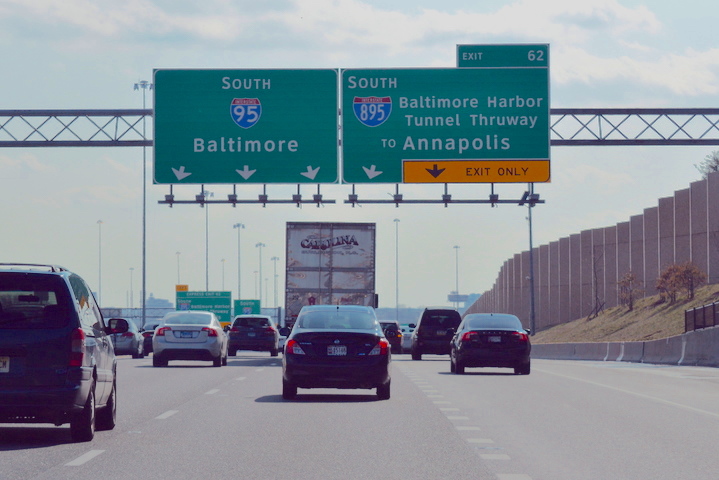
This is a snapshot of the I 95 South/I 895 South highway fork. Now, thanks to the improvement, the user will notice the proper relative direction and interchange information.
| Before | After |
| Continue on I 895 South | Keep right to take exit 62 onto I 895 South toward Annapolis |
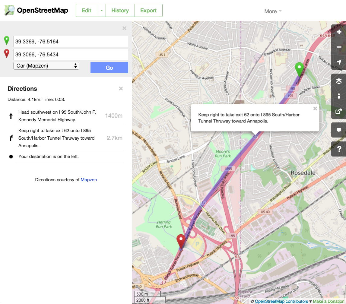
View on OpenStreetMap
Bicycle Narrative Improvement
The bicycle narrative needed to shed unwanted pounds maneuvers and properly handle the cycleway circles (roundabouts). We collapsed the unnamed maneuvers and added the cycleway label. Also, we fixed the exit spoke count for cycleway circles.
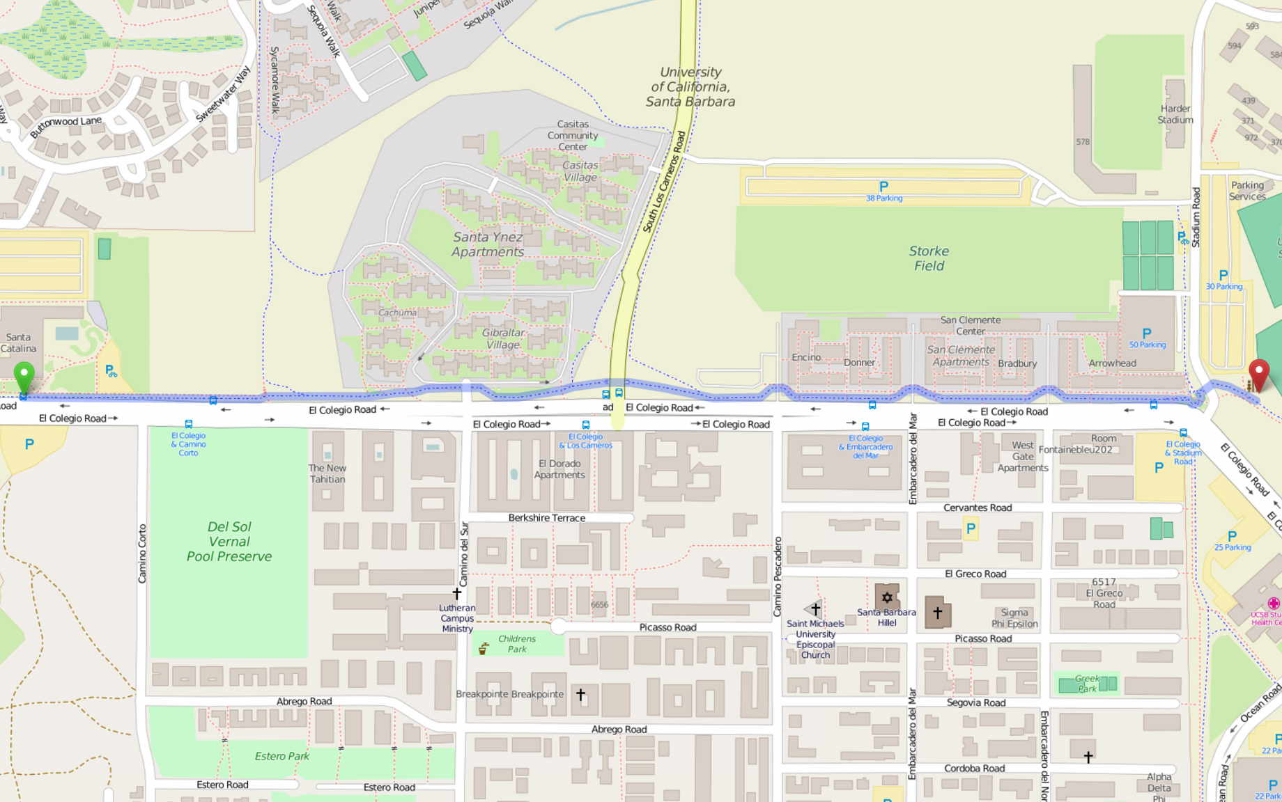
| Before | After |
| Go east. | Head east on cycleway. |
| Continue. Continue. Continue. Continue. Continue. Bear right. Continue. Continue. Bear right. Bear right. Continue. Turn right. Bear left. Continue. Bear left. Bear right. Bear left. Continue. Bear left. Bear right. Continue. Continue. Continue. | (Collapsed unnamed maneuvers) |
| Enter the roundabout and take the 1st exit. | Enter the roundabout and take the 2nd exit. |
| Exit the roundabout. | Exit the roundabout onto cycleway. |
| Turn right. Continue. Turn right. | (Collapsed unnamed maneuvers) |
| You have arrived at your destination. | Your destination is on the left. |
View on OpenStreetMap
Pedestrian Narrative Improvement
We updated the logic to call out a turn at a ’T’ intersection even if the street names are the same, making it clear to the user which way to go at the ’T’ (Onyx Drive in the example below). We softened the start maneuver (Go vs. Head) and added the side of street to the the destination maneuver.
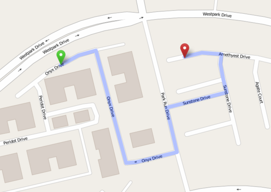
| Before | After |
| Go northeast on Onyx Drive. | Head northeast on Onyx Drive. |
| Turn right to stay on Onyx Drive. | |
| Turn left onto Park Run Drive. | Turn left onto Park Run Drive. |
| Turn right onto Sunstone Drive. | Turn right onto Sunstone Drive. |
| Turn left to stay on Sunstone Drive. | |
| Turn left onto Amethyest Drive. | Turn left onto Amethyest Drive. |
| You have arrived at your destination. | Your destination is on the right. |
View on OpenStreetMap
We hope these make it even easier to integrate Mapzen Turn-by-Turn into your apps and maps. Check out the documentation and let us know if you have any questions.
